Haul Road Monitoring
In the dynamic world of open-pit mining, the safety and efficiency of haul road systems are critical for seamless operations. Integrating cutting-edge technologies such as drones and aerial data has emerged as a game-changer in the monitoring and maintenance of haul roads. This article delves into the applications, benefits, and real-world examples of utilizing drone technology for haul road monitoring, catering to the technical audience of mining engineers, geologists, and safety engineers.
Routine Haul Road Inspections:
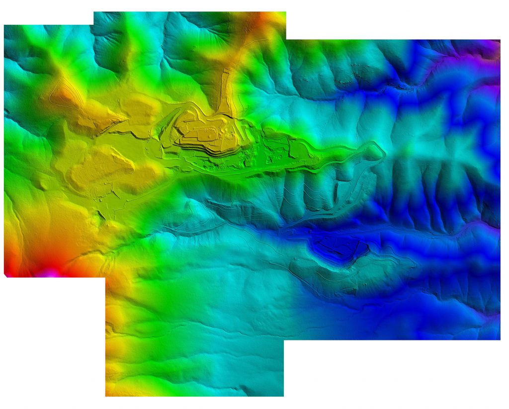
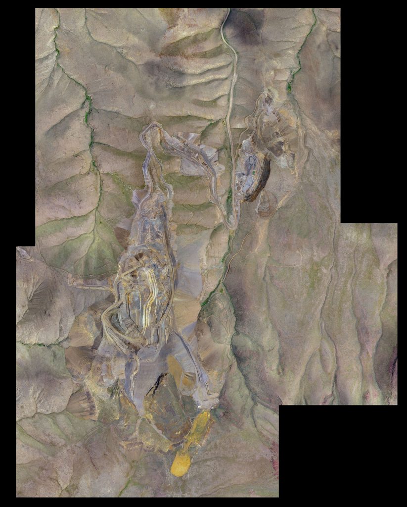
Drones equipped with high-resolution cameras and LiDAR sensors are instrumental in conducting routine inspections of haul roads. These unmanned aerial vehicles (UAVs) can efficiently cover vast areas, capturing detailed imagery and 3D mapping data. Safety engineers use this data to identify signs of wear and tear, erosion, and other potential hazards.
Use Case: In a large open-pit mine, drones are deployed to inspect haul roads regularly. The captured data is analyzed to identify areas with surface irregularities, potholes, or deterioration. Safety engineers use this information to prioritize maintenance efforts and schedule timely repairs, ensuring the longevity and safety of the haul road network.
Slope Stability Monitoring:
Haul roads often traverse challenging terrains with steep slopes. Drones equipped with advanced sensors, including inclinometers and accelerometers, can assess the stability of these slopes. Safety engineers utilize the collected data to evaluate potential risks of landslides or slope failures, enabling proactive measures to mitigate these risks.
Use Case: In a mining operation situated in a geologically complex area, drones equipped with slope stability monitoring sensors fly over haul road slopes. The data collected helps safety engineers assess the stability of the terrain, identify areas prone to movement, and implement slope stabilization measures to prevent accidents and disruptions.
Surface Deformation Analysis:
Drones equipped with photogrammetry capabilities can detect subtle surface deformations on haul roads. This is crucial for identifying areas undergoing subsidence or settling, which may impact the structural integrity of the road. Safety engineers use this information to prevent potential accidents caused by uneven road surfaces.
Use Case: In a mine with expansive haul road networks, drones capture high-resolution images of the road surfaces. Engineers use specialized software to analyze these images and detect any signs of deformation. The resulting data guides maintenance teams in addressing subsidence issues promptly, ensuring a stable and safe haul road infrastructure.
Traffic Monitoring and Pattern Analysis:
Drones with advanced imaging capabilities and artificial intelligence algorithms can monitor haul road traffic patterns. Safety engineers leverage this data to assess the frequency and types of vehicles using the roads. This information is crucial for optimizing traffic flow, identifying congestion points, and ensuring safe operational practices.
Use Case: In a busy open-pit mine, drones capture aerial footage of haul road traffic during peak operational hours. Engineers analyze this data to understand traffic patterns, identify potential bottlenecks, and optimize haul truck routes. This proactive approach minimizes the risk of collisions and enhances overall traffic safety within the mine.
Reporting for Maintenance and Regulatory Compliance:
Engineers working in mines are required to produce detailed reports for both maintenance planning and regulatory compliance. Drone-derived data on haul road conditions, slope stability, and surface deformations contribute to comprehensive reports. These reports detail current conditions, recommended maintenance schedules, and adherence to safety regulations.
Use Case: Safety engineers compile a detailed report using drone-collected data, highlighting the current state of haul roads, identified maintenance priorities, and compliance with safety standards. This report serves as a crucial tool for decision-makers, guiding resource allocation and ensuring that the haul road network aligns with industry regulations and best practices.
The integration of drone technology and aerial data in haul road monitoring represents a paradigm shift in open-pit mine safety and operational efficiency. From routine inspections and slope stability assessments to surface deformation analysis and traffic monitoring, drones offer a comprehensive solution for maintaining a safe and robust haul road infrastructure. As the mining industry continues to embrace technological advancements, the use of drones in haul road monitoring is poised to become an indispensable tool for ensuring the safety and sustainability of open-pit mining operations.